Oak Island Researchers Turn to New Heat Map as Fresh Discoveries Push Lot 15 Into Focus
Oak Island Researchers Turn to New Heat Map as Fresh Discoveries Push Lot 15 Into Focus
In a renewed effort to understand the origins of Oak Island’s most puzzling artifacts, investigators have unveiled a comprehensive heat-mapping project that is reshaping the team’s priorities and redefining where they believe early depositors may have worked. The new analysis, led by surveyor Steve Guptill with support from researchers Emma Culligan and Jillian McKinnon, brings decades of finds together in a single visual system designed to assess age, distribution and potential intent across the island.
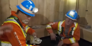
The presentation, made in the war room before Rick and Marty Lagina, Craig Tester and senior members of the operation, marks one of the most ambitious data-driven approaches yet deployed on Oak Island. Using colours to indicate estimated artifact age, the map highlights clusters where historically significant material appears concentrated.
“We are here today to feel the heat,” Marty said as the team gathered. “They were charged with taking everything recovered on Oak Island over the years and placing it by likelihood of age. That’s a lot of material.”
The heat map employs four colours: pink for objects dated to 1725 or earlier, orange for the mid-18th century, green for transitional periods, and blue for artifacts believed to be from 1800 onward—typically classified as searcher activity. The earliest layers, the pink zones, immediately drew attention.


“Right now, the two hot areas where depositors could have been are Lot 5 and the Money Pit,” Steve explained. “But we’ve found very old artifacts in other locations as well.”
One of those locations, Lot 15—marked on the map by several unexpected pink and orange points—quickly became a focal point of discussion. Situated roughly 200 yards northwest of the Money Pit, the parcel has produced some of the island’s most enigmatic artifacts, including charcoal thought to date to the 14th century, a Chinese coin potentially more than 1,000 years old, and a pre-17th-century cannon stone shot traced to the Azores.
The heat map, for the first time, displayed these items in direct relationship to each other.
“When you see those older ones up there on Lot 15,” Rick observed, “I think there’s a lot more work to do.” Marty agreed. “We’ve barely touched the surface,” Billy Gerhardt added. “It makes sense to concentrate there.”
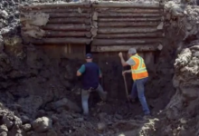
Following the meeting, Rick, Gary Drayton, and Steve set out for Lot 15. To boost detection accuracy, Billy had plowed the area using a tractor, turning the soil in a method borrowed from English farmland archaeology—bringing deeper artifacts closer to the surface.
Gary’s metal detector signaled almost immediately. The first find was a fragment of coal—light, brittle, and out of place. Its presence raised new questions, given coal had previously been discovered along the so-called Portuguese stone road in the swamp.
“If this is the same type of coal found near that roadway,” Rick noted, “we may have yet another connection between Lot 15 and the swamp.”
Moments later, the detector chimed again. This time, a hand-forged rosehead spike emerged—an artifact type frequently dated to the 16th through early 18th centuries. Similar spikes have been recovered from both surface layers and from more than 150 feet down in the Money Pit, adding weight to theories of early construction or occupation.

“These go all the way back to the 1500s,” Gary said. “And we’ve found them in the Money Pit. These are valuable finds.”
Steve confirmed that the spike would be added to the heat map—another data point reinforcing Lot 15’s growing significance.
Further investigation produced a third object: an iron pintle, traditionally used as a hinge pin for doors or gates, but also capable of supporting lanterns or tools. Gary pointed out that such hardware was historically used in mining environments, including deep shafts where lighting was essential.
“It could be meaningful,” he added. “This could go way back.”
As each artifact was logged, flagged and bagged for laboratory assessment, the team’s confidence grew that Lot 15 may hold a central role in the island’s earliest activity—potentially even tied to those who engineered the Money Pit or other now-buried structures.
Rick summarized the shifting perspective emerging from the heat-map analysis and the morning’s discoveries.
“We are now convinced the mystery is island-wide,” he said. “And you go back to where you’ve been successful before. It’s highly appropriate to continue on Lot 15.”
With deeper excavations planned and new data tightening the focus, Lot 15 is rapidly becoming one of the most promising zones in Oak Island’s ongoing investigation—an area where early materials, diverse origins and unexplained patterns converge more clearly than ever before.